The new Prague Geoportal brings revolutionary changes in the provision of geographic data. It also offers a digital twin of the city.
The Prague Institute of Planning and Development (IPR Prague) has launched a new Geoportal for the city. The platform has undergone extensive technological, content, and design modifications, offering users a wide range of improvements. One of the new features is a photorealistic model of Prague, which offers a high-quality reproduction of a real bird's eye view of the city.
The Geoportal is visited by more than 500 users per day. These users can now enjoy many new functionalities that not only make it easier to work with the data when downloading it, but also support automatic processing. In addition to the creation of new sections, such as a special page for municipal districts or the Atlas of Prague application, the way in which data is provided has also changed significantly.
Ondřej Boháč, Director of IPR Prague, notes: "The new Geoportal makes it even easier to work with Prague's geographic data. It is faster, more intuitive, and contains many new features. In addition to easier data searches, the user has the opportunity to view all open data in an interactive window and thus get a better overview of the data they are working with. The download options in different formats and coordinate systems are also significantly richer. We believe that users will appreciate the new form of the Geoportal."
A significant change also concerns the open data, which has been completely redesigned. Data is now downloaded directly from the map window, which increases the efficiency of the process. The vector open data has a newly generated API, which allows easy connection to the data without the need for repeated downloads. This innovative approach to data retrieval is particularly effective when the data is used by applications.
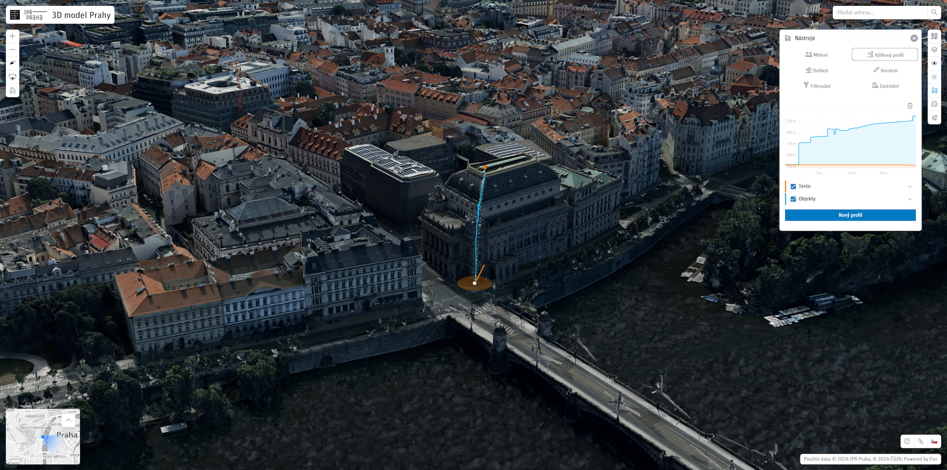
"The new version of the 3D model offers several new features that can be used across the city administration's specialized offices, and they will be used extensively by private entities as well. Examples include the ability to measure distances, areas, or elevations very accurately. Only a few cities in the world have such a detailed model, among them Vienna, Helsinki, Hamburg, Rotterdam, and Singapore, which are also cities with which Prague cooperates on data models," Boháč adds.
Jiří Čtyřoký, Director of the Department of Spatial Information at IPR Prague, says: "The launch of the Geoportal does not signal the end of our efforts to improve it. We are preparing additional improvements and upgrades in the coming months to ensure that data provision in Prague will be at a high level not only within the Czech Republic, but also on a European scale. In the future, we plan to update the building model based on newly acquired aerial data and we would like to model selected important buildings in greater detail."
For its work with spatial information and the way it is presented and provided to the public, IPR Prague received one of the world's most prestigious awards in the field of data and geography from Esri in 2022.
The new Geoportal can be found at https://geoportalpraha.cz, where it is also available in English. It is fully executable on mobile devices thanks to a redesigned user interface.
You might also be interested in

Prague residents live in economically mixed areas, according to a new analysis by IPR Prague.

DEVADE: Prague's Architecture Amidst Austerity and Disco. A new book and exhibition at CAMP map Prague of the 1990s.